


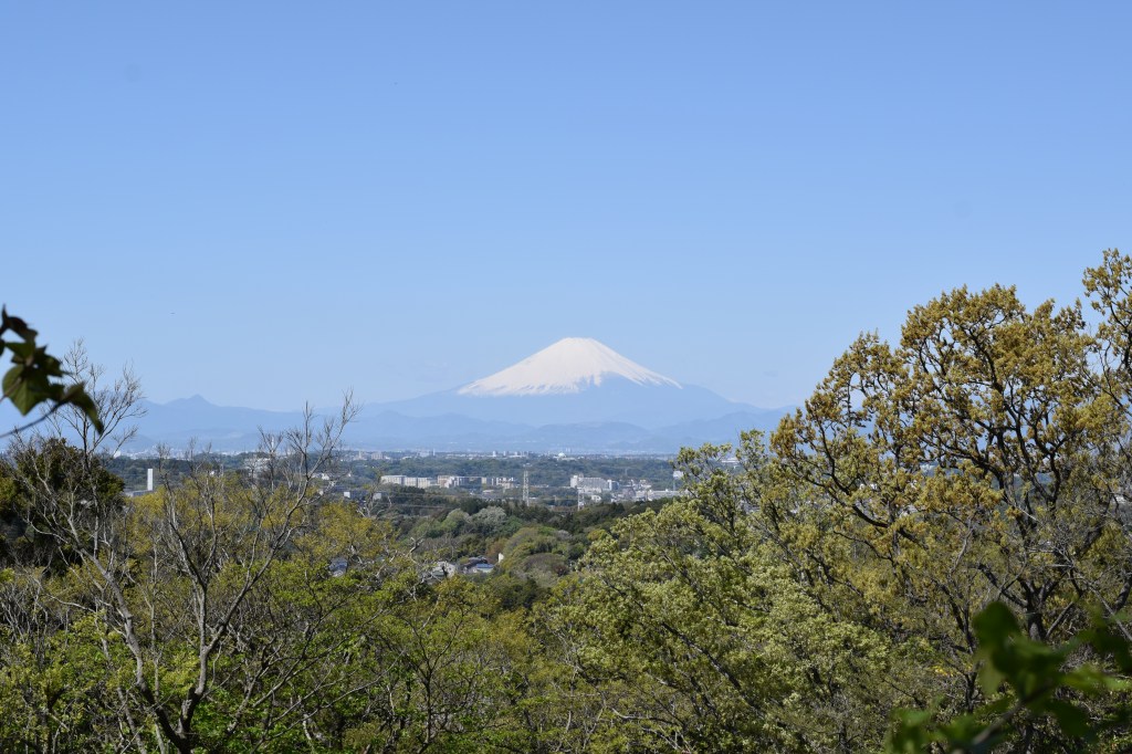
One of my favourite trails leads up out of the southern suburbs of Yokohama, into a beautiful nature reserve and then through on to the Ten’en trail – one of the trails that winds up and around the hills of Kamakura. On a clear day, like the last time I walked it in April, you get spectacular views over Kamakura and Sagami Bay with some lovely views of Fuji as a bonus. The trail wraps up by winding through rocky outcrops and a thick forest, taking you to the peak behind Kencho temple where you can have one last long look over the city and the sea, before coming down from the hills.

Leave Konandai Station by turning left out of the ticket gates, and head straight up the gentle hill for about five minutes, past shops & restaurants until you reach the T junction of the Konandai Iriguchi traffic lights.
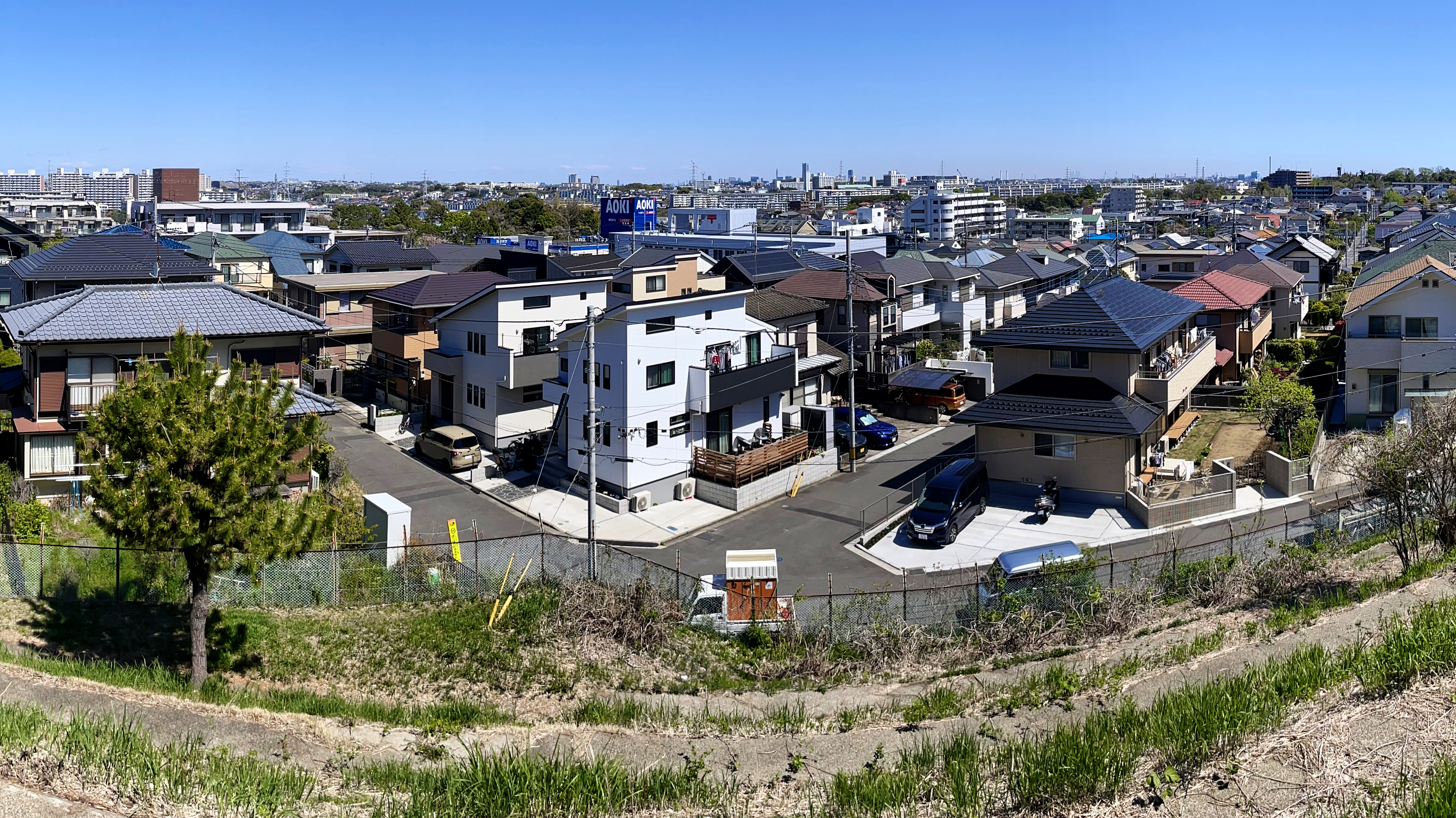
Hang a left, keep on going straight until you hit another busy junction – this time a major intersection – and make sure you’re on the right hand side of the road. Keep going past the fire station until you see a Mercedes dealership on your side of the road and a Royal Home Center on the opposite side. Take the road uphill on your right, head past the vet (yes, that’s why there is so much barking) then on up to some brilliant views over southern Yokohama and beyond. You should easily be able to see Landmark Tower and the Yokohama Bay Bridge.
Keep going until you reach the top of this section of hill, then hang a right. This will be the last climb for a while; it takes you up to a coastguard transmitter and, if the weather is co-operating, your first good view of Mount Fuji.

The trail through Mount Enkai Citizen’s Forest (Enkaizan shuhen shimen no mori/ 円海山周辺市民の森) starts back at the coastguard transmitter, slightly off to the left of where you came up the hill.

After a few minutes down this path, you’ll see the trail split; if your Japanese isn’t up to snuff, make sure you know the kanji for this route because you won’t see a lot of English – you’re going to be heading for Kamakura (鎌倉) via the Ten’en trail (天園ハイキングコース). Head down the right hand side here, into a clearing with a big map that gives you information about all the trails. You’ll be following the green A trail straight on from here for a good while, thirty to forty minutes or so, until you reach Sekiyaoku point. (関谷奥 – I think, I didn’t take a picture…!) Here you switch from the green A trail to the brown G trail.

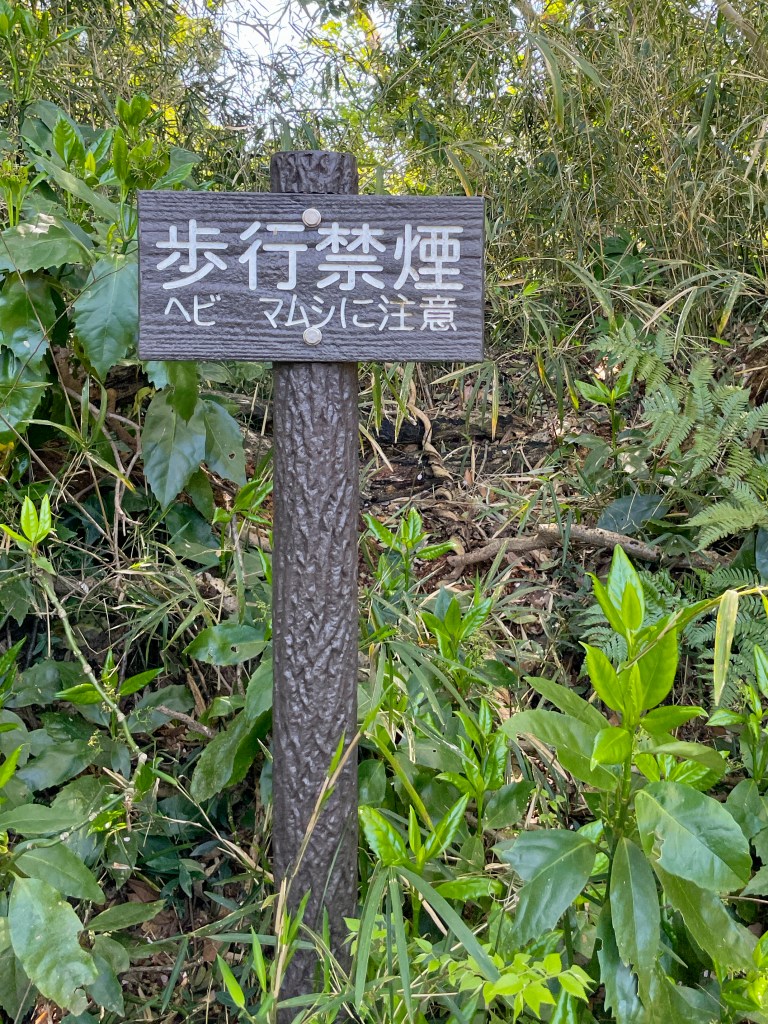
Make sure you stay on the trail as there are mamushi (Japanese pit vipers) in these woods and these are, if I recall correctly, the most venomous snakes in Japan. They tend to keep themselves to themselves, however. I’ve certainly never seen any in this forest. Doesn’t mean you shouldn’t pay attention.
When you come to the A6 sign post take a right. Follow this trail until you get to the A9 marker which also has a big map beside it – take the trail leading off from the map.
Just after the A10 marker, you’ll encounter a set of stairs on your left which will take you up to the summit of Maruyama. There’s a bit of a view up there, but it’s not really worth the detour unless you’re some kind of a weirdo completionist. (ahem.)
Past these steps about ten minutes or so you should reach another fork – take the left trail. The right goes to the nature centre which is pretty cool but you’re not even halfway done with the trail yet. Save the centre for another time.
Further on down this part of the trail, you’ll see another set of stairs on your left. You can go up these to a little clearing and some benches if you fancy taking a break but otherwise, keep on straight and follow the signs for the Ten’en trail.
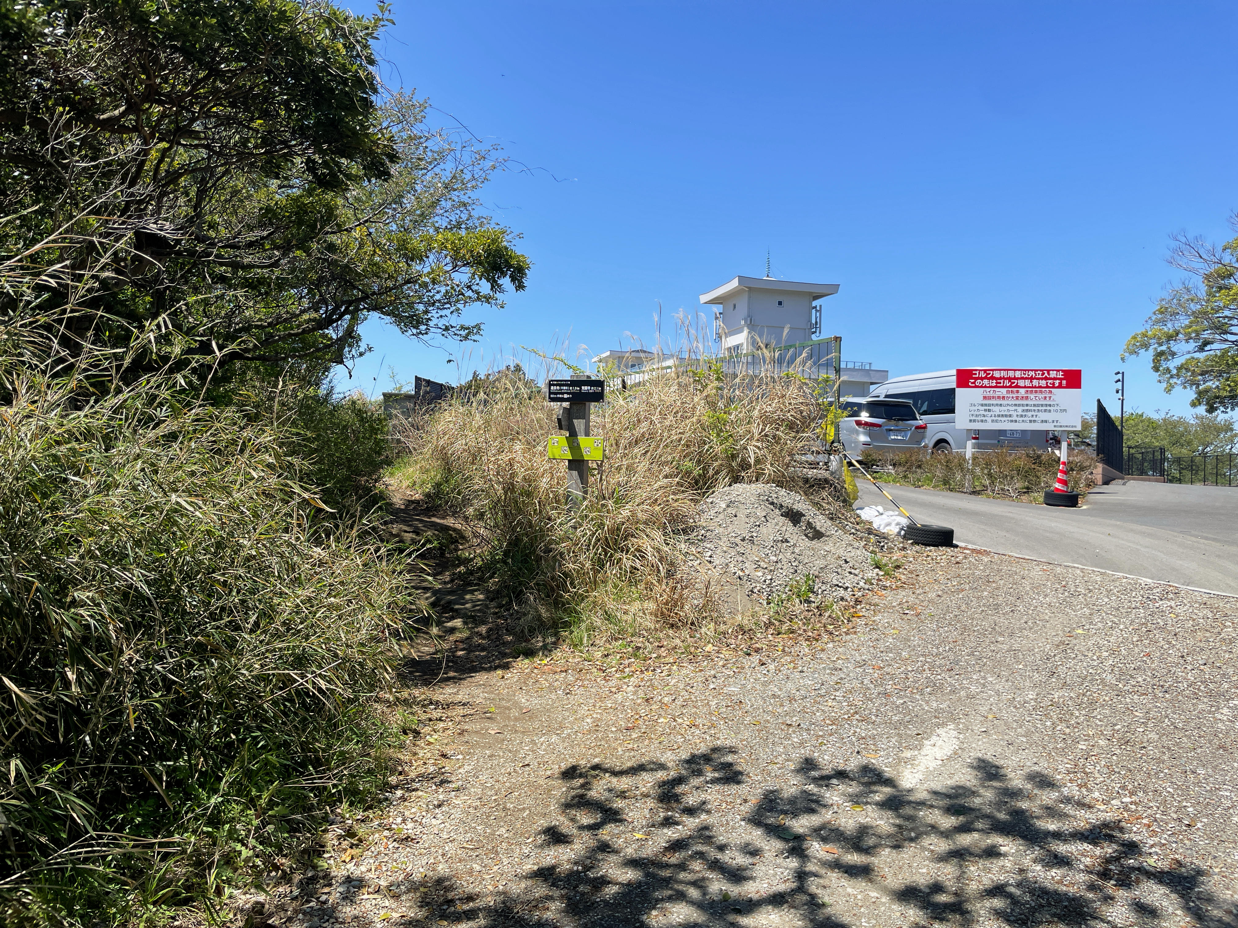
The Ten’en trail is and always has been, appallingly signposted, but thankfully, there are very few turnoffs. Just keep walking for about fifteen to twenty minutes, following the trail past a graveyard down to your right and then on up again into the hills towards Kamakura Country Club. You are heading for Kenchoji (建長寺) at this point. There is a turn off down to Zuisenji (瑞泉寺) just before the country club if you’d prefer.
For Kenchoji, take a left just before the country club car park and follow the Ten’en trail up over some rocky outcrops to reach Mount Ohira – the tallest point of Kamakura at a staggering (!) 159.2 metres.


From here, it’s a steep downhill until the trail levels out a little before beginning to climb again. You’ll start to see more signposts now – most of which are utterly redundant since they point in the only direction possible.
Keep an eye out for the junction where you can either walk down to Kakuonji (覚園寺), continue up to Kenchoji (建長寺) or head into Imaizumidai 6 Chome (今泉台六丁目). Kakuonji is a lovely temple, very peaceful, so worth a visit if you’re not feeling like much more climbing. But it is a long walk down there and an even longer walk back into Kamakura. The last of the options will take you into a lovely residential neighbourhood but it’s a very long walk to your final destination so you may as well stay on the trail and enjoy the scenic route up to Kenchoji.

Once you’ve finished taking in the sights and caught your breath from that last push uphill, you can enter Kenchoji from here – although you may have to pay the admission fee (there’s not always someone on the gate) – or, if you’re not in the mood for sightseeing then you can just follow the trail down to Imaizumidai 4 chome. This is the same neighbourhood from before but this section of it is much closer to Kita-Kamakura train station.
The station is very well signposted, so just enjoy a leisurely stroll past beautiful homes in a peaceful suburb winding downhill until you reach Meigetsuin (明月院), the temple famous for its full moon window and its hydrangeas. There are a couple of cosy teahouses just past the temple before you reach the train tracks. Turn right here and either walk past, or make a quick stop at, Engaku-ji (円覚寺), before coming to Kita-Kamakura (北鎌倉) train station.
From here you can head to Ofuna and get connections to pretty much anywhere, or head on into Kamakura proper and do some tourist dodging sightseeing.

Leave a comment